Why go
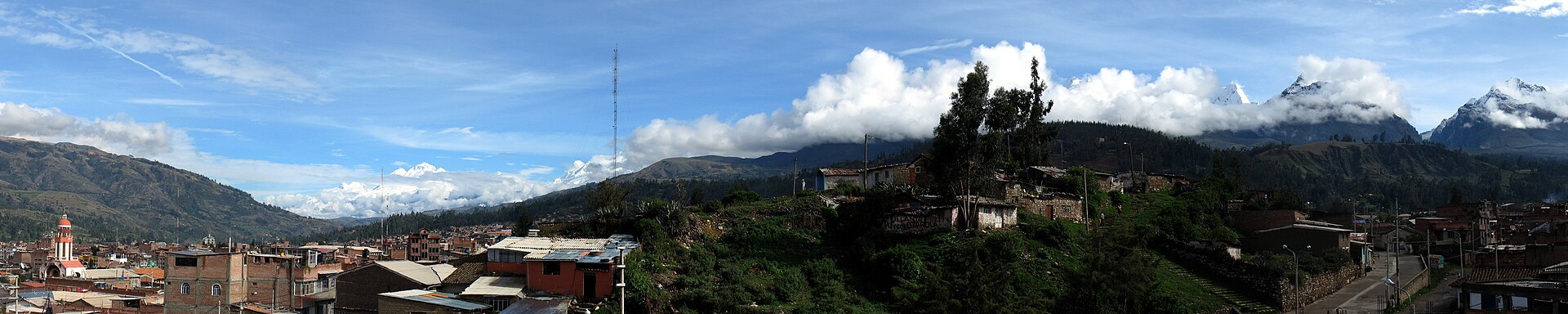
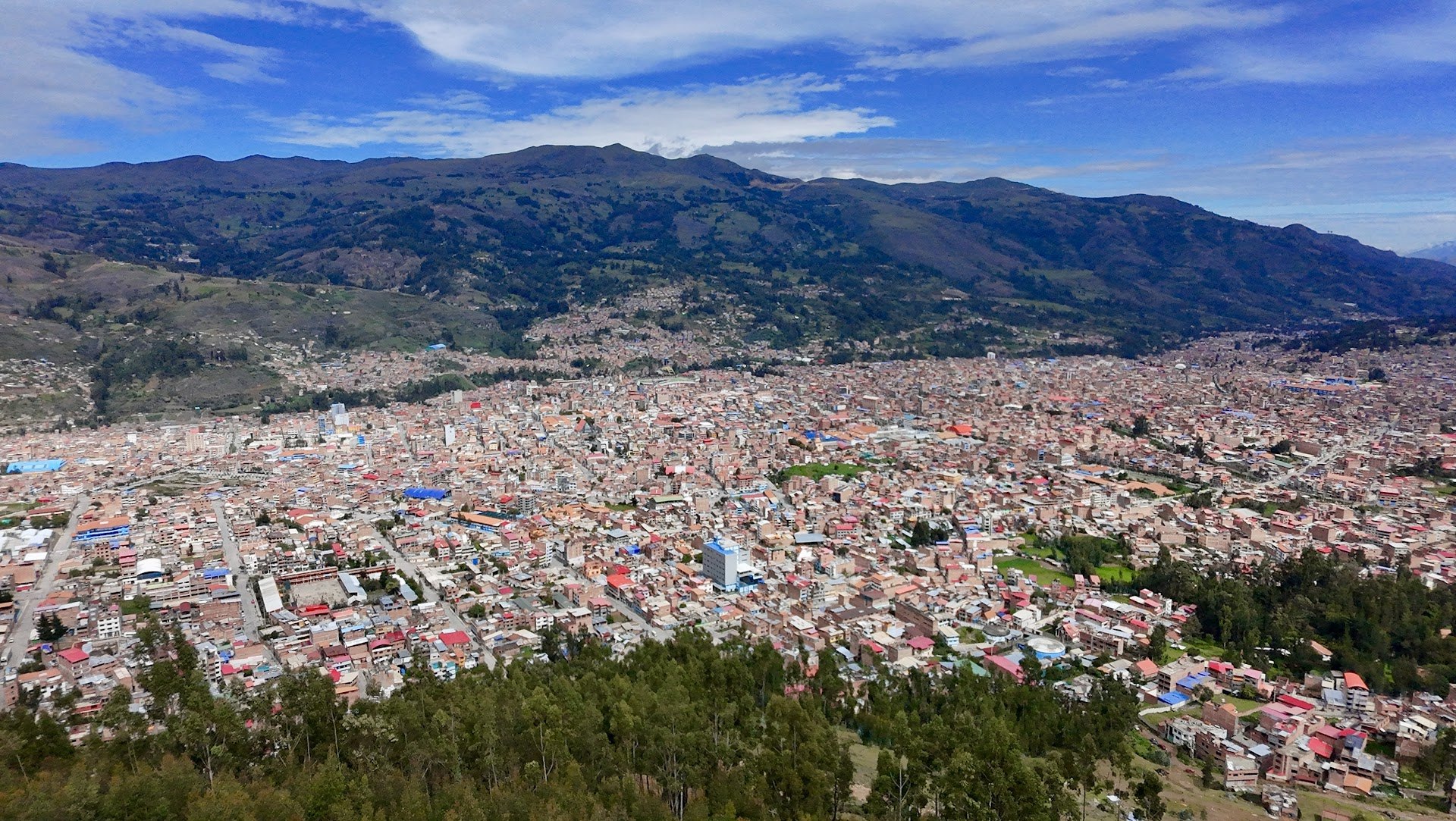
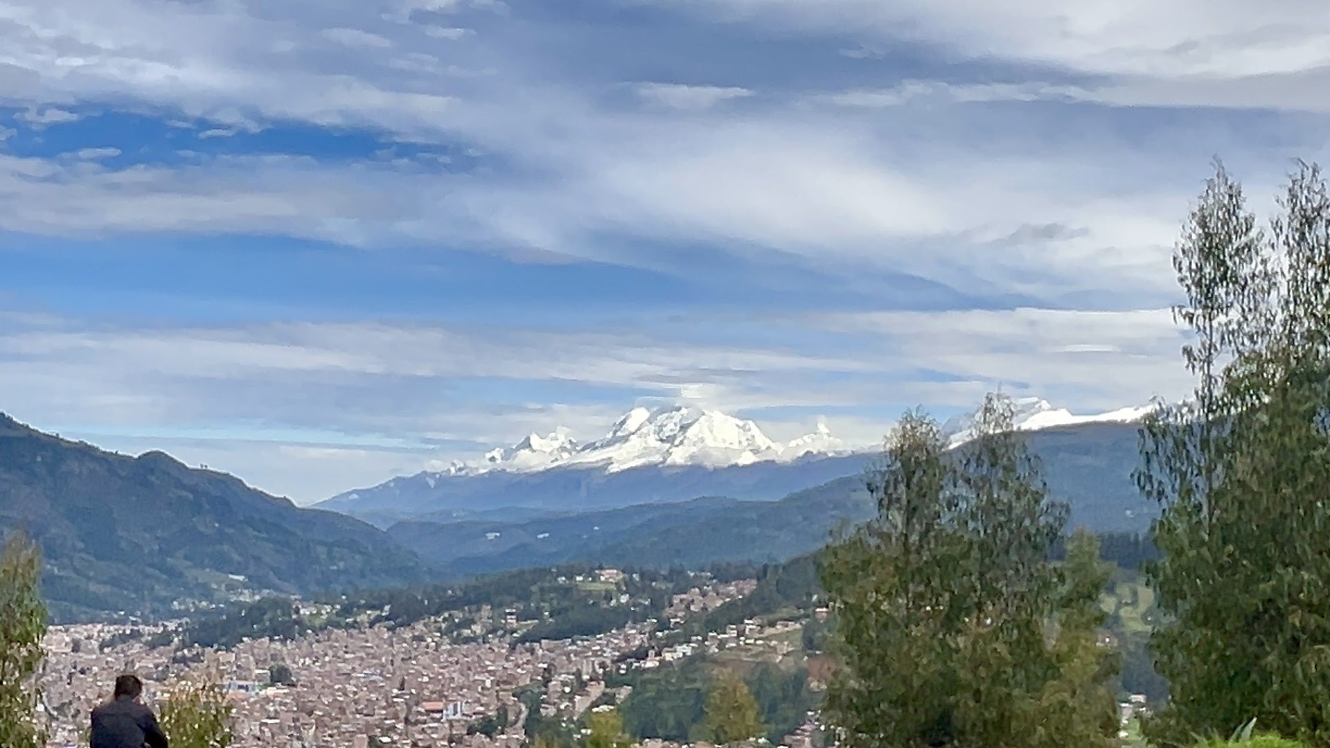
Rataquenua rises southeast of Huaraz and provides one of the clearest panoramic readings of the city. From 3,314 metres you can see the urban grid, the Cordillera Negra and, when skies are clear, a long succession of Cordillera Blanca peaks. The large cross on the hill adds religious meaning and makes the viewpoint a pilgrimage destination.Gallery and visual history
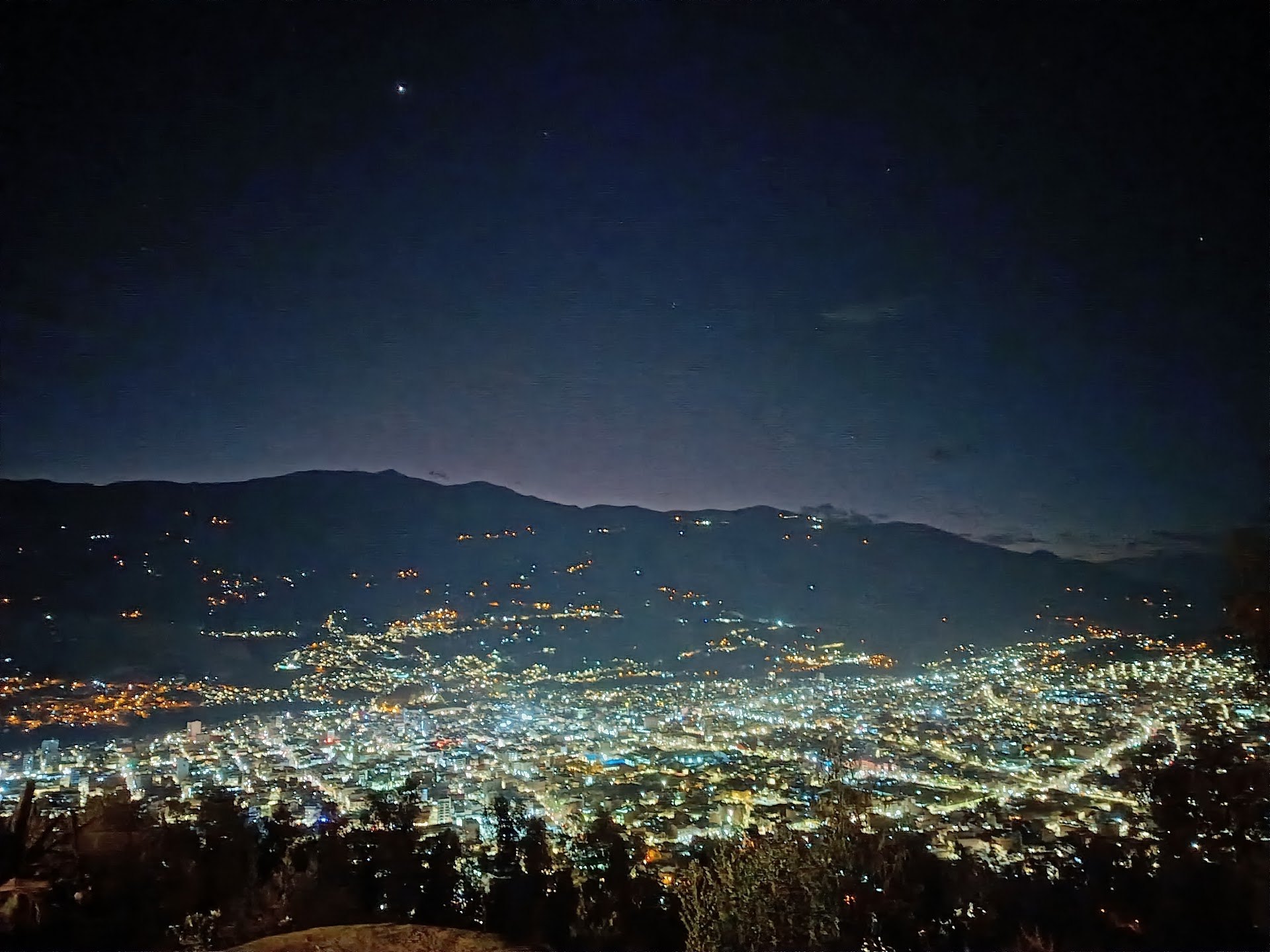
What you can see
- The city of Huaraz spread across the valley.
- The Cordillera Negra to the west.
- Cordillera Blanca peaks including Huandoy, Huascarán, Chopicalqui, Copa, Vallunaraju, Tullparaju, Rima Rima and Churup on clear days.
- Nearby fields, eucalyptus and Andean crops.
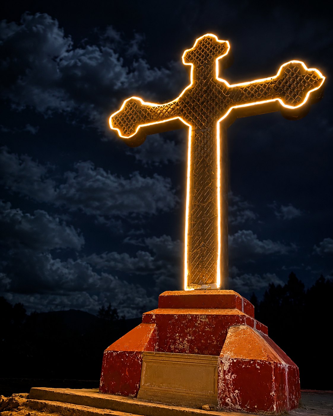
- The large Rataquenua cross, visible from the city.
The real difficulty
Arriving by taxi or car is easy and requires little physical effort. Walking from the cemetery is moderate: the route climbs continuously for 2.2 km to 3,314 metres. Starting in central Huaraz adds urban distance, so allow roughly one to one and a half hours each way depending on pace.
Daylight and sunset
Rataquenua changes with the light. Morning reveals peaks and neighbourhoods; near sunset the city begins to glow and the cross becomes the focal point. A night visit needs planning: reference public hours end at 18:00 and hiking the route after dark is not recommended.
Visit responsibly
- Carry all rubbish back to the city.
- Respect the cross and religious activities.
- Stay on visible routes and avoid unsafe edges.
- Keep noise low and protect vegetation.
- Confirm access, weather and return transport before leaving.
History and significance
Rataquenua has long been recognised as a strategic viewpoint over Huaraz and its Andean setting. The hill dominates the eastern side of the city, while its large cross has become a landmark visible from many neighbourhoods.The cross has special religious value. Peru's official tourism inventory identifies the viewpoint as the destination of pilgrimages and a Way of the Cross linked to the patron saint of Huaraz. Rataquenua is therefore more than a photo stop: it is also part of the city's spiritual memory and collective traditions.
Public clean-up and maintenance campaigns have taken place in recent years. In 2026, Huaraz Municipality also approved an informational signage project for the Rataquenua–Pukaventana walking route, reflecting ongoing efforts to improve orientation and conserve the landscape.
How to get there
The official route from Plaza de Armas is approximately 4.4 km. The first paved section reaches Huaraz Cemetery after 2.2 km; a further 2.2 km follows an unpaved road to the viewpoint. A taxi or car ride is short, depending on traffic and road conditions. Walking uphill from the cemetery takes an estimated 45–60 minutes, varying with pace and weather.Before you go
Visit in the morning for clear mountain views and cooler walking conditions. Late afternoon brings warm light, but begin your return before visibility fades. The official inventory lists reference hours of 06:00–18:00. For city-light photography, first confirm current access, arrive by vehicle and arrange a safe return; never hike up or down alone after dark.What to bring
Bring water, a hat, sunscreen, a wind layer and grippy shoes. A wide lens works for the city panorama, while a telephoto lens isolates the snow peaks. Do not rely on food or drinks being available: a restaurant was listed in 2022, but its current operation should be confirmed.The best photograph
Morning light favours the Cordillera Blanca; late afternoon brings out the city grid and Cordillera Negra. The illuminated cross and city lights are striking, but night photography requires secure access and transport. Do not climb structures, block paths or approach unprotected edges.Safety
By vehicle the visit is easy and family-friendly. Walking from the cemetery makes it moderate because of the uphill grade, altitude and unpaved surface. Avoid improvised shortcuts, never hike alone after dark, supervise children and carry all rubbish out. Check road conditions during the rainy season.Frequently asked questions
Is there an entry fee?
The official inventory lists free admission. Confirm current conditions before visiting.
What is the elevation?
3,314 metres above sea level, roughly 260 metres above central Huaraz.
How difficult is it?
Easy by vehicle. Moderate on foot from the cemetery because of the 2.2 km uphill route and altitude.
Can children or older adults visit?
Yes, preferably by vehicle and with close supervision at the viewpoint. Evaluate the uphill walk according to fitness.
Is it safe at night?
We do not recommend hiking up or down after dark. Reference public hours are 06:00–18:00. For sunset, confirm access and arrange return transport.
When is the best season?
It can be visited year-round, but May to October is generally drier and clearer.
Sources and verification
Operational details can change. The following primary sources were consulted:
Mirador de Rataquenua — MINCETURVisitas al Mirador de Rataquenua — Municipalidad Provincial de HuarazMantenimiento y limpieza en el Mirador de Rataquenua — Gobierno Regional de ÁncashSeñalización informativa de la ruta Rataquenua–Pukaventana — Municipalidad Provincial de Huaraz